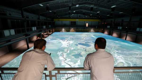
A look at the Lower Mississippi River Physical Model built to help understand the last stretch of the river before it empties into the Gulf of Mexico and the effect of diversions cut into the river’s levees to fight coastal erosion:
— HOW BIG IS IT? The model itself is 90 feet by 120 feet (27 meters by 37 meters). It’s made out of 216 high-density foam panels that weigh 700 pounds (318 kilograms) apiece. Underneath are 864 jacks holding up the model.
— WHAT DOES IT SHOW? The model represents 14,000 square feet (1,300 square meters) of territory in southeastern Louisiana and a 179 mile stretch (288 kilometers) of the river running from Donaldsonville to the Gulf of Mexico. Overhead are 20 high resolution digital projectors that can project images onto the white model.
— HOW ARE RESEARCHERS USING IT? The model is helpful to researchers studying sediment diversions — large cuts made into levees along the Mississippi River in Louisiana in order to extract sand and use it to rebuild land. There are 18 acoustic sensors on the model to monitor water levels.
——
Information from officials at the Coastal Protection and Restoration Authority and Louisiana State University.
Sourse: abcnews.go.com


