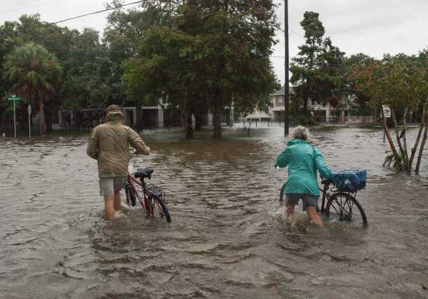
Before Hurricane Barry made landfall in Louisiana over the weekend as a tropical storm, forecasters predicted potentially dire impacts for the coast.
The National Hurricane Center said that the storm would bring 15-20 inches of rain to southeast Louisiana and southwest Mississippi over the weekend. The Mississippi River, already swollen with prior heavy rains, would crest close to 20 feet near New Orleans. A storm surge as high as six feet would inundate some coastal areas. Severe flooding would reach as far inland as Baton Rouge.
A tiny spot along the Louisiana coast did report up to 15 inches of accumulated rain on Sunday, but most parts of the Gulf Coast, including most of the area expecting a deluge, received just 2 to 6 inches of rain. This was still enough to cause flooding, damage homes, and knock out power to 153,000 customers in Louisiana, but far less than what was expected.
Meteorologists have drastically improved how well they can forecast the path of cyclones like hurricanes in recent decades. The National Hurricane Center can now better forecast the path of a hurricane 72 hours in advance than it could just 24 hours in advance in 1990.
But the rain from tropical storms can be more difficult to predict, as Barry showed. And since forecasts help govern what precautions people need to take, who is forced to evacuate, and where they should go, the stakes for getting it right are high.
Populations are growing in coastal areas, so more people are at risk from hurricanes. And climate change contributing to the increasing severity of extreme weather events. The hazard is growing, so it’s worth unpacking why the signals from Barry pointed to a more severe storm than what actually materialized.
Barry showed early signs that it would devastate the Gulf Coast
Forecasting Barry’s rain proved difficult in part because the storm itself had an unusual shape. “This storm did not look like your typical hurricane,” said Rosimar Rios-Berrios, a research meteorologist who studies hurricanes at the National Center for Atmospheric Research. “There was no clear eye or swirls of clouds around the eye.” So it was harder to track where moisture-carrying clouds would go.
There were other signs that Barry would drop a lot of rain. One was its sluggish speed. “The rain is going to be there because it’s a very slow-moving storm,” said Freddie Zeigler, a lead forecaster in the New Orleans/Baton Rouge office of the National Weather Service, told the New York Times last week. The concern was that it would park over a metropolis like New Orleans and dump moisture, similar to how Hurricane Harvey stalled over Houston in 2017 and broke rainfall records for the city.
Another factor was that Barry’s clouds were spread out over a large area, allowing the storm to soak up a lot of moisture from the ocean. “The region of clouds was very extensive and it was sitting over very warm waters,” Rios-Berrios said. “This was giving us hints that it could have left very strong rainfall over land.”
That huge volume of moisture was expected to fall on already high water levels in the Mississippi River, which was riding high from unusually heavy rains across its basin throughout the late spring and summer. This past May capped the wettest 12-month span in the United States on record.
Barry also started to intensify shortly before landfall, reaching hurricane wind speeds above 74 miles per hour as it hit the coast Saturday morning. This intensification threatened to draw more rain clouds towards its eye and drop more precipitation on land.
Barry’s heaviest rainfall ended up far away from land
While the raw ingredients for a destructive storm were in place, they did not coalesce over the areas that were projected to get the most rain over the weekend. And Barry quickly lost steam shortly after landfall and was downgraded to a tropical storm by Saturday afternoon.
A major factor was that dry air over the continental United States helped keep the rain at bay. Storms behave in complicated ways when they collide with dry air and it is hard to predict in forecast models, according to Rios-Berrios.
Another factor was vertical wind shear. The winds that drove Barry were pushing in different directions at different altitudes. Closer to the surface, the wind pushed the storm toward the shore. At higher altitudes, it kept the moisture over the Gulf. “What wind shear tends to do is it displaces all the clouds and precipitation away from the center as it did in Barry,” Rios-Berrios said.
The result was that the dominant share of Barry’s rainfall poured out over the ocean.
“Most of the moisture, where the 20-plus inches of rain occurred, stayed out in the Gulf of Mexico for longer than expected,” meteorologist Dave Hennen told CNN. “By the time it did move inland, the storm had weakened, so the rainfall totals were held down.”
He also noted that forecasters underestimated some aspects of the storm. “The storm surge in the populated areas like New Orleans didn’t rise to the level to cause major problems,” Hennen said. “That being said, there was surge to 7 feet in a few areas, which was actually higher than forecast.” Louisiana officials said that no levees were overtopped by the storm surge.
Rios-Berrios said that Barry showed that storms can still surprise us and that despite all of our advances, we’re still trying to answer some critical fundamental questions about how hurricanes dish out rain. “From a research perspective, what I have learned about it is we need to better understand the processes that get together to generate heavy rainfall,” she said.
Without an accurate idea of how a storm will strike, it’s much more difficult to prepare. Utilities often get repair crews ready before hurricanes make landfall, but they’re much more effective if they can stage near the areas projected to get hit hardest. Accurate forecasts are also important for directing evacuations since roadways can get flooded.
That Barry ended up being weaker than expected is nonetheless a relief for people along the Gulf Coast. But forecasters warn that the remnants of Barry are still pouring rain in the region with 4 to 6 inches of rain expected in Louisiana and Mississippi on Monday, raising flash flood warnings until Tuesday, according to the National Hurricane Center.
Before the storm dissipates, total accumulated rainfall could still rise to 20 inches in some areas of Louisiana. So the rain that was expected over the weekend could still arrive, albeit behind schedule.
Sourse: vox.com


