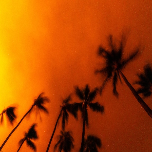
Climate change is expanding the list of areas at risk for the worst wildfires.

Kylie Mohr is a freelance journalist based in Missoula, Montana. She has written about wildfires and the environment for various outlets including National Geographic, the Atlantic, High Country News, E&E News/Politico and Hakai Magazine, among others.
All a wildfire needs is oxygen, an ignition to spark it, and fuel to burn. Its crackling embers and flickering flames don’t know the difference between the California foothills, where residents are used to fire, and more unexpected locales, like the New Jersey coastline, the Florida peninsula, or the slopes of the Blue Ridge Mountains. As the immense destruction of the fire in Lāhainā, Maui, continues to unfold, experts who study wildfires say the blaze fits a disturbing pattern of fires in the wildland-urban interface, where people and homes mingle with burnable vegetation. “Every single state in the US where we have vegetation, and particularly where we have vegetation intermixing with communities, we have the potential for extreme fire disasters,” said Crystal Kolden, a pyrogeographer who studies fire across time and space at the University of California Merced.
According to researchers and numerous tools mapping wildfire risk, hundreds of cities, towns and communities outside the flammable, arid West that’s known for its wildfires face similarly high risk. The models tell the tale of surprising fire risk for homes near forests, shrublands, prairies, and coastal marshes: They include populated areas in New Jersey’s Manchester and Bass River townships, as well as dollops of development throughout the Eastern coastline that are downwind from over a million acres of pine forests— ripe fuel for fast-moving fires. “That scenario is catastrophic,” said Greg McLaughlin, New Jersey Forest Fire Service chief. “That’s what we plan for.” The state has already seen 13 major wildfires this year, about triple the average.

Homes, towns, and reservations in northern Minnesota are also at moderate to very high risk. In the western corner, prairie grasses are often quick to burn; in the east, flammable spruce and conifer forests surround the gateway communities to the Boundary Waters Canoe Area Wilderness like Ely. Risk extends throughout the state to communities just north of the Minneapolis-St. Paul metro area.
Other pockets of high and very high fire risk include the Gulf of Mexico near the Texas-Louisiana border, home to flammable coastal vegetation and large swaths of Florida peninsula, where grasses, cattails, and the dense everglades can easily combust. Communities on the eastern, downwind side of the Blue Ridge Mountains in North Carolina and the towns tucked near the heavily forested Appalachian Mountains in southern Kentucky are also surrounded by thick forests and prone to wildfire. Here, there’s precedent: Blazes that started in Great Smoky Mountains National Park swept downwind in 2016 and killed 14 people in Gatlinburg, Tennessee.

Wildfire risk is modeled by combining the likelihood and the intensity of a blaze with an area’s exposure and susceptibility. Widely used models include the US Forest Service’s Wildfire Risk to Communities, the Federal Emergency Management Agency’s (FEMA) National Risk Index, and Risk Factor, a model created by the nonprofit First Street Foundation that looks at fire and other climate risks down to the neighborhood and address level. Some models use the same data but parse risk differently, looking at just housing units or also factors like building values and population to determine a final risk. Some models are searchable by address or neighborhood, while others summarize risk at a county or state level.
While risk modeling maps aren’t predictive, they can be eerie in hindsight. “Scientifically, physically, we know where these risk regions are,” said Daniel Swain, a climate scientist at the University of California Los Angeles. “And they’re everywhere.” One model says Merryville, Louisiana, where wildfire recently forced a town-wide evacuation, has a higher wildfire risk than 72 percent of communities in the country; another says the town has a moderate risk of wildfire over the next 30 years. And Lāhainā, for example, had a very high risk of wildfire, more than 92 percent of communities in the country. Now, upward of 115 people are dead and hundreds are still missing. “There are lots of places that are flammable, and there are places that are becoming more flammable, and then there’s places that are becoming more flammable that weren’t on our radar,” said Jennifer Balch, a fire ecologist at the University of Colorado Boulder.
A devastating pattern, worsened by climate change
While each fire has its own context, a pattern keeps repeating: fast-moving fires that sweep through communities and catch their inhabitants off guard. Strong winds are a common thread between blazes like the Marshall Fire, a grass fire that destroyed 1,000 homes in Colorado in 2021, the Almeda Fire, which burned 600 homes in southern Oregon in 2020, and the recent fire on Maui. But wind needs to line up with another wildfire risk factor — dry vegetation — to be dangerous. “That really might not happen often at all, barely ever in some places,” Swain said. “But when it does, watch out.”
Places with high wildfire risk include coastal areas with vegetation like Phragmites, an invasive wetland grass that’s found throughout the Eastern seaboard and elsewhere, or cogon and sawgrasses, found in the Florida marshes. Invasive species are often adapted to take over landscapes quickly after fire, pushing out native grasses and providing a carpet of especially flammable fuel for the next blaze.
Many ecosystems evolved with fire as a natural element of the landscape, said Allissa Reynolds, the wildfire prevention supervisor for the Minnesota Department of Natural Resources Division of Forestry. But fire suppression policies and the stifling of Indigenous burning practices limited natural and human-introduced fire in the last century, causing a buildup of excess fuel.
Today, climate change further stacks the deck toward a higher risk of wildfire, even in places that have been traditionally too wet to burn with much frequency or severity. Wet conditions can allow fuels to grow, but heat waves can quickly dry them out. “It’s getting easier and easier for vegetation to dry out to critical levels,” Swain said. Wildfire risk then concentrates in the “driest dry spells and the hottest hot spells,” he said. And risk factors don’t have to line up often to be dangerous if and when they do.
That’s happening right now in Minnesota, where most of the state is experiencing some level of drought. The state has already seen almost its yearly average of fires, despite fall, a historically active time, still to come. It’s occurring in New Jersey, where an increasing number of fires are happening outside the usual mid-March to mid-May fire season. And it’s underway in the Gulf Coast during hurricane season, where unusual drought and heat at a time that should be wet are fueling over 600 fires burning in Louisiana, including the largest fire in recorded state history. “While we’re pretty good and practiced at emergency response, not so much on the wildfires,” Louisiana Gov. John Bel Edwards told CBS News.
When flames meet homes
Between 1992 and 2015, 1 million homes were within the perimeter of a wildfire and almost 59 million more were within roughly half a mile, according to one study. While there’s been increasing development in the wildland urban interface in recent years — to the tune of more than 32 million residential homes — new homes aren’t the whole story. “That’s a broad generalization that I don’t think adequately captures the scale of risks that we’re seeing,” said Kimiko Barrett, a research and policy analyst at Headwaters Economics, a research organization in Montana.
Economics play a role here, too: Rising housing costs mean more populations priced out of urban areas find more affordable housing in the nearby shrubs and woodlands that pose more wildfire risk. “Suggesting that people just shouldn’t keep building out there is a really privileged viewpoint that ignores why people move to the fringes of these areas,” Kolden said. Plus, many Indigenous settlements would be considered to be in the wildland urban interface today, by modern definitions. “People have been living at moderate densities in fire-prone places for a long time,” said Chris Roos, an environmental archaeologist. Tribes used and continue to use fire to steward and manage the land, often lighting many small fires to improve hunting and gathering opportunities as well as lower their wildfire risk.
But wildfires that continue to torch communities prompt questions of not just where we live but how we prepare. “It’s tragic that we don’t currently have this larger education about what to do in a no-notice evacuation event, what to do if you get caught by a wildfire,” Kolden said. Fire-prone areas are already working to mitigate their risk and develop evacuation plans for the worst-case scenario. Members of the Forest Service, land management agencies, local fire departments, and county emergency managers are sitting down throughout Minnesota and the rest of the country to create community wildfire protection plans; the process opens the door to federal funding that can pay for things like creating fuel breaks and turning yard waste into wood chips. Prescribed burning that targets areas with an accumulation of vegetation is a priority in New Jersey, and an almost 1,400 acre thinning project in the Bass River State Forest is slated to start in September, with the goal of removing excess fuel.
It will also take investment in urban environments — like retrofitting old homes with fire-resistant building materials and creating building codes for new development — to curb the wildfire crisis and lessen risk, Barrett said. “The inertia of the political system and us as a society continue to believe we can get through this wildfire crisis if we just focus on the forest and the wild lands,” she said. Wildfire isn’t just a Western problem or a forest problem or a rural problem. Given the right combination of factors, wildfire can occur where you least expect it — in suburbia or in the former capital of the Hawaiian Kingdom.
Source: vox.com


