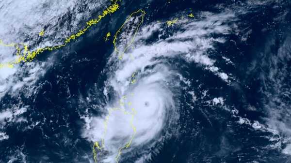
TAIPEI, Taiwan — Typhoon Saola strengthened overnight as it continued its path across the Pacific early Wednesday and headed for China’s southern coast.
The typhoon was moving northwest with sustained winds of 191 kph (118 mph) and gusts of up to 234 kph (145 mph), according to Taiwan’s Central Weather Bureau, and is now considered a strong typhoon. The typhoon’s eye won’t hit Taiwan’s mainland, but the storm’s outer bands will hit the island’s southern cities.
The weather bureau also warned of heavy rain and strong winds in Taiwan’s southern cities, especially southern Pingtung county. The typhoon is currently traveling directly south of Taiwan, in the Bashi Channel, the band of ocean that separates Taiwan and the Philippines.
The typhoon passed by the Philippines earlier this week, without any reports of casualties so far. However, in the northern part of the islands, the typhoon’s torrential rains and fierce winds enhanced seasonal monsoon rains, flooding low-lying villages and displacing nearly 50,000 people, including 35,000 villagers, who fled to government-run evacuation centers. Seaports suspended inter-island ferry services due to rough seas, and more than a hundred houses were damaged.
The typhoon is expected to hit China’s southern Fujian and Guangdong provinces on Friday. China’s National Meteorological Center said the storm is expected to weaken as it approaches land.
___
AP writer Jim Gomez contributed to this report from Manila, the Philippines.
Sourse: abcnews.go.com